|
| Tri-StateDiving.com Photo Gallery
|
|
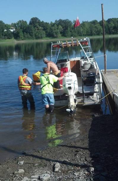
On August 27, 2013 Ryan T and Seal traveled to International Falls to do a job for the United States Geological Survey (GSGS). We were contracted to place a sensor on the bottom of the Rainy River at the Ron Hall Public Water Access. We left DL at 5:30 that morning and meet the USGS crew at the site about 9:30. The plan was to use the Deep Diver as a base and have their boat bring the sensor out to the site but when we got there, we were told that their boat and trailer were in International Falls having new tires put on the trailer. Ryan and I then decided that the best way to move the sensor to the site was to put a lift bag on it, attach a rope to it and pull it out to the site. We then took the Deep Diver out and anchored it over the site and then pulled the sensor out to the site and then lowered it to the bottom. Here are some pictures showing the placement of the sensor.
|
Ryan filling the lift bag. Sensor cable lying by shore
|
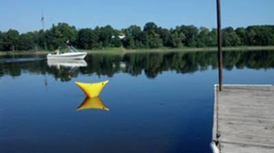
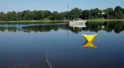
This picture shows us getting the boat anchored over the site for the sensor installation. This picture shows everything set up to start pulling the sensor out to the site. This show the sensor next to the boat over the site before the lift bag was deflated. |
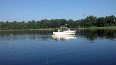
The following video shows the underwater operation. If you listen closely you can hear the noise made by water going over the dam about a mile upstream. Once the sensor was positioned we placed anchors in the bottom of the river to hold the sensor in place just in case someone hooked it with an anchor or fishing line. There were sturgeon coming to the surface by the boat while we were diving.
The operation went very smoothly and the only glitch was they could not get their laptop to link up with the sensor for a while when we were trying to alien the sensor. Here is a link that gives the details of what the sensor is recording. http://waterdata.usgs.gov/nwis/uv?site_no=05129515
The sensor is attached to a cable that lies on the bottom of the river and then is buried in the ground from the shore up to a box on the hill. The information is then sent up to a satellite and back down to the USGS offices.