Bottom Time E-Mail News Archives
September 9, 2013
The weather has been nice for diving this past week and it looks like it will be warm through at least this week. The school finally got the pool up and running the first week of school so we were not able to run a July or August class. For those of you needing to finish out classes we will let you know when we will have classes starting in the spring so you can finish your training.
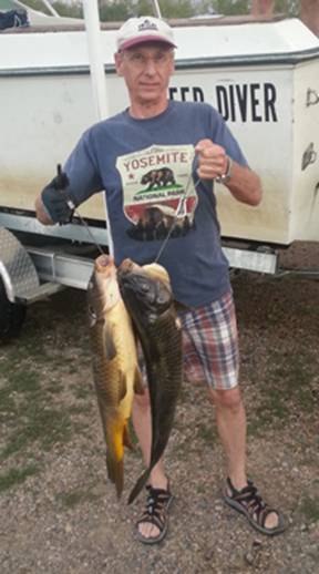
Some of us have been spearfishing this last couple of weeks. Rick Schmidt speared these two carp on August 31 on Big Cornmorant Lake. Total weight of the two was 20 pounds. I speared one and only had one band on the spear and it did not penetrate the carp so the barbs did not open up and it got away. Chris Winter and Duane Tabbut were also along. They saw one fish but could not get a shot off.
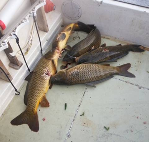
On September third Rick Schmidt and I went spearingonBig Cornmorant and I speared 5 carp total weight 63 pounds. One weighted 14 pounds.
We are now handling the Polar Pro filters for the GoPro cameras. They now have three models for diving. Red and Magenta plastic filters, Red and Magenta glass filters, and a Red/Marco Glass filter. The Red filters are for salt water and the Magenta filters are for fresh water. I have been using them and I am really impressed on how the videos have been turning out.
Last spring the Becker County Museum asked me to give a presentation on all the things I have found underwater. The local TV station TV3 filmed the show and aired it on their station about 3 weeks ago. Here are the links the watch the show. They divided it into 3 episodes.
http://www.youtube.com/watch?v=GuyKyiFPIcI&feature=youtu.be
http://www.youtube.com/watch?v=rDTXnvws3t0&feature=youtu.be
http://www.youtube.com/watch?v=4cnDEfcSMSo&feature=youtu.be
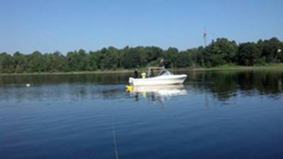
On August 27, 2013 Ryan Tangen and Seal traveled to International Falls to do a job for the United States Geological Survey (GSGS). We were contracted to place a sensor on the bottom of the river at the Ron Hall Public Water Access. We left DL at 5:30 that morning and meet the USGS crew at the site about 9:30. The plan was to use the Deep Diver as a base and have their boat bring the sensor out to the site but when we got there their, we were told that their boat and trailer were in International Falls having new tires put on the trailer. Ryan and I decided the best way to move the sensor to the site was to put a lift bag on it and attach a rope to it. We then took the Deep Diver out and anchored it over the site and then pulled the sensor out to the site and then lowered it to the bottom. Here are some pictures showing the placement of the sensor.
Ryan filling the lift bag Sensor cable lying by shore
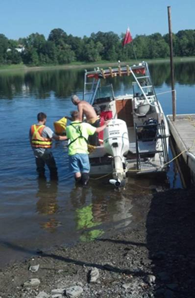
This picture shows us getting the boat anchored over the site where the sensor will be floated out to.
This picture shows everything set up to start pulling the sensor out to the site. The two ropes attached, one the boat and
the other one handled by a person from the dock to prevent the sensor from floating downstream.
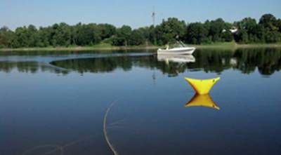
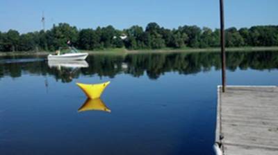
This show the sensor next to the boat over the site before the lift bag was deflated.
Behind the boat you can see a white drift float just in case a diver came up away from the boat he could grab onto and pull himself back to the boat preventing being pulled down stream.
The video shows the underwater operation. If you listen closely you can hear the noise made by water going over the dam about a mile upstream. Once the sensor was positioned we placed anchors in the bottom of the river to hold the sensor in place just in case someone hooked it with an anchor or fishing line. There was sturgeon coming to the surface by the boat while we were diving.
http://www.youtube.com/watch?v=TJ3yzgGzmwo
The operation went very smooth and the only glitch was they could not get their laptop to link up with the sensor for a while when we were trying to alien the sensor. Here is a link that gives the details of what the sensor is recording. http://waterdata.usgs.gov/nwis/uv?site_no=05129515
The sensor is attached to a cable that lies on the bottom of the river and then is buried in the ground from the shore up to a box on the hill. The information is then sent up to a satellite and back down to the USGS offices.
Remember we are now in our winter hours. Please call to make sure I am around before coming out to the dive center.
Sea You on the Bottom
Tri-State Diving Making Diving Safe and Adventurous