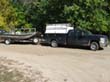
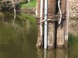
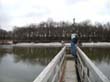
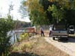
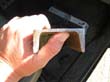
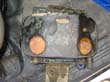
Oct. 6, 2011 Ryan Tangan and I traveled south of the Minneapolis/St. Paul airport on the Minnesota River to recover a sensor for the USGS that was attached to a piling on a pier that went to the bottom when the spring flood broke the piling and sent the pier to the bottom. The river was about 10 feet over the top of the pier. It took about 15 minutes to locate the piling and then I had to locate the sensor which was almost on the underside of the piling. We thought we would be able to unbolt the channel iron but we could not get at the bolts. Then I wish I would have brought the cutting torch along but with some cutting with a hacksaw Ryan and I were able to cut the channel. Visibility was poor even with a headlamp.
 |